Log in
Email
Password
Register
Menu
Explore
Newest photos
Popular photos
Contribute
Submission guidelines
Photographer signup
Photographer login
About
About Freerange
Image license
API
Contact us
Support
Contact support
FAQ
Login
Login
Register
Search all
Photos
Illustrations
Match All
Match Photo ID
Newest
Popular
Select Category
AI Generated
CC0 Images
Editorial and News
Animals & Insects
Architecture
Architectural Details
Arts & Music
Backgrounds & Textures
Cities and Modern Life
Business & Office
Flowers and Plants
France
Food & Drink
Holidays & Occasions
Health and Fitness
Landmarks
Interiors
Illustrations
Industry & Agriculture
Landscapes & Nature
Letters and Numbers
Objects
Other
Military
People
Signs & Symbols
Sky and Clouds
Space
Sports & Recreation
Technology
Wallpapers
Free Stock Images
Sponsored images from Shutterstock
View footage results
Click to save 15% sitewide with code
FREERANGE15OFF
View More
111 free Atlas photos from Freerange
Filter results
Popular
Most Viewed
Newest Photos
All licenses
Freerange
CC0
Photos & Illustrations
Photos
Illustrations
Per Page
25
50
100
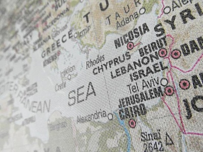
Map of Israel with Greece and Turkey
Close up of map of Israel with Greece and Turkey with names of cities and states
USA Map (East Coast)
Close up of east coast USA Map with names of cities and states
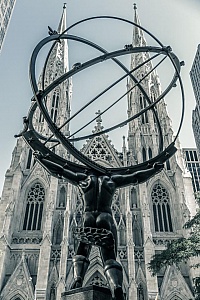
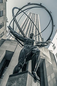
Statue of Atlas at Rockefeller Center
Famous bronze of Atlas holding the world in front of Rockefeller Center in New York City.
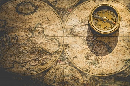
Vintage compass on an ancient world map
An antique brass compass laying on an ancient map depicting the world of a bygone era, evoking adventure and exploration
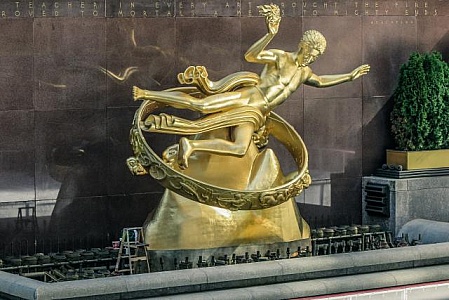
Gold Statue at Rockefeller Center
The gold scuplture that overlooks the ice skating rink at Rockefeller Center in New York City.
Military Transport Plane
View of Airbus A400M Atlas Plane flying in the Sky \r\n
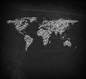
World map on blackboard - Sketchy looks
World map on blackboard - Sketchy looks
Detailed road atlas map of Boston, Massachusetts area.
A close-up view of a detailed road atlas map showing Boston and surrounding areas in Massachusetts, highlighting various districts, landmarks, and transportation routes with precision.
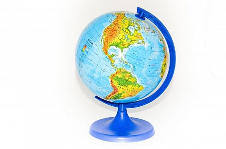
Blue and Yellow Globe on White Background
A blue and yellow globe positioned on a stark white background. The globe is prominently displayed, showcasing its vivid colors with clarity and precision. The contrast of the colors against the white backdrop creates a striking visual impact.
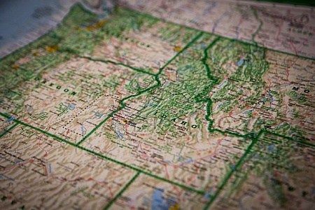
USA Map (West Coast)
Close up of west coast USA Map with names of cities and states
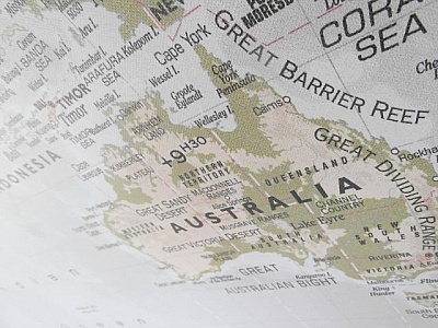
Australia Map
Close up of map of Australia with names of cities and states
USA Map with names of states and cities
Close up of United States of America Map
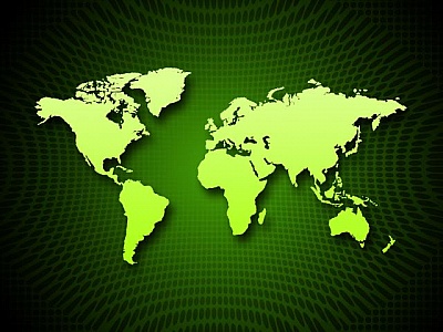
Detailed World Map on Dark Green Background
A detailed world map displayed over a dark green background, showcasing continents, countries, and oceans in clear contrast. The map is informative and easy to read, providing a comprehensive view of global geography.
World Map on Dark Blue Background
A world map is prominently displayed in the center of a dark blue background. The map features countries, continents, and oceans, providing a clear overview of the Earths geography.
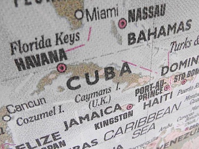
Cuba Map
Close up of map of Cuba with names of states and cities
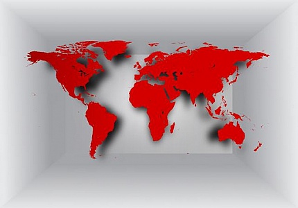
World map on 3D background
World map on 3D background
Focus on India and neighboring countries on a globe.
A detailed image of a globe focusing on India and its neighboring countries in South Asia, highlighting geographical features, borders, and significant landmarks.
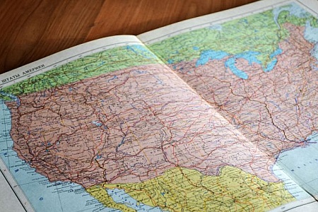
Detailed map of the United States of America on paper.
A detailed paper map of the United States is spread out on a surface, highlighting various states, geographical features and road networks, ideal for travel planning and educational purposes.
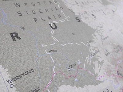
Russia Map
Close up of map of Russia with names of cities and states
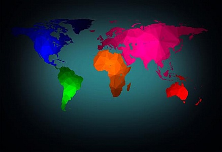
World map with modern triangle pattern - Color-coded Continents
World map with modern triangle pattern - Color-coded Continents
Detailed close-up of Russia and Asia on a globe.
Close-up of a globe focusing on Russia and neighboring Asian countries, exhibiting detailed geographical information and significant landmarks of the region.
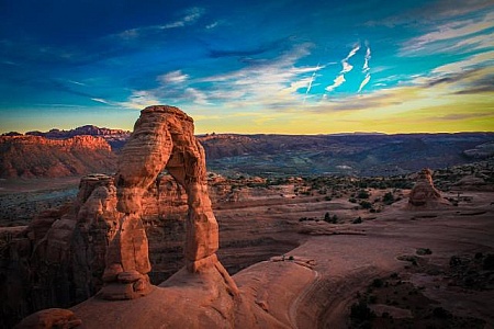
Large Rock Formation in Desert
A massive rock formation stands prominently in the vast desert landscape, towering over the arid terrain. The rock formation is a striking feature amidst the barren expanse of sand and scrub, showcasing the harsh and unforgiving nature of the desert environment.
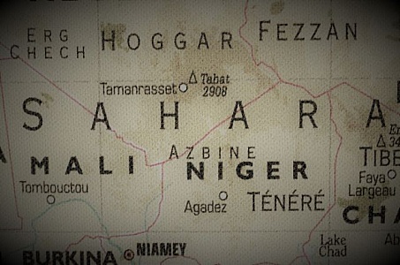
Old Sahara Desert Map
Old Sahara Desert Map
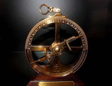
16th-Century Portuguese Nautical Astrolabe - European Age of Dis
16th-Century Portuguese Nautical Astrolabe - European Age of Discovery
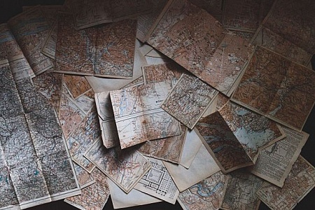
A Pile of Old Maps
Several worn and wrinkled maps are stacked haphazardly on top of each other. The maps show signs of age with faded colors and torn edges, suggesting extensive use over time.
Detailed map displaying the geographic layout of America.
A detailed, full-page image of a map of America, highlighting the geographic regions and boundaries, giving an in-depth look at the landmasses, topography, and place names across the country.
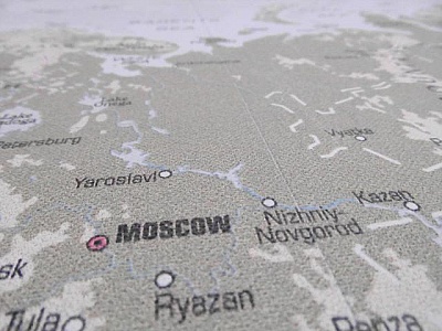
Map of Russia
Close up of map of Russia with names of cities and states
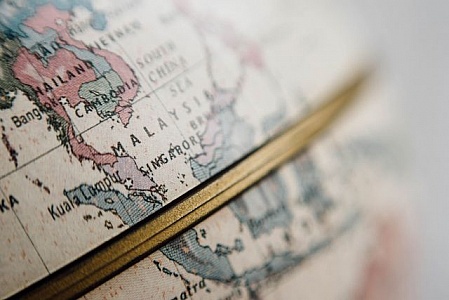
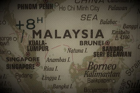
Old map of Malaysia
Close up of map of Malaysia with names of states and cities
Alaska highlighted on a globe along with surrounding areas.
This image focuses on Alaska as highlighted on a globe, showing its location, cities such as Fairbanks and Anchorage, and neighboring Canadian regions, emphasizing detailed cartography.
Close-up of detailed geographic map
A highly detailed geographic map focused on the topology and landscape of a region
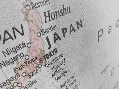
Map of Japan
Close up of Japan map with names of cities and states
World map
View of earth map wallpaper on the wall
The Internet of Things - Global Cloud Concept
The Internet of Things - Global Cloud Concept
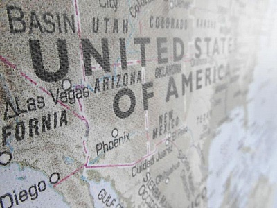
United States of America ( Map)
Close up of USA Map with names of cities and states
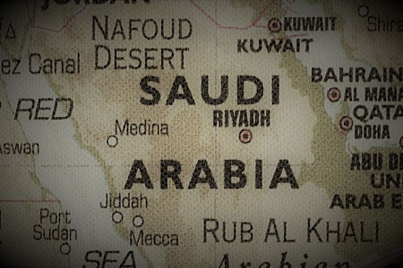
Old map of Saudi Arabia
Close up of map of Saudi Arabia with names of cities and states
Atlas faces St. Patrick s Cathedral
Back of Atlas in Rockefeller Center faces the front of St. Patrick s Cathedral in Manhattan.
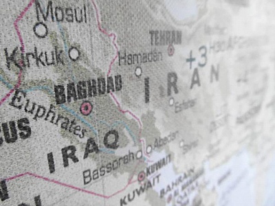
Iraq Iran Map
Close up of map of Iraq and Iran with names of cities and states
Colorful South African continent with major cities labeled.
The globe image highlights Africa with a focus on South Africa, displaying a colorful representation of national boundaries, names of countries, major cities, and surrounding regions.
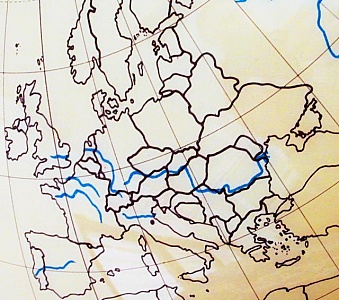
Map of Europe
Atlas Map of Europe
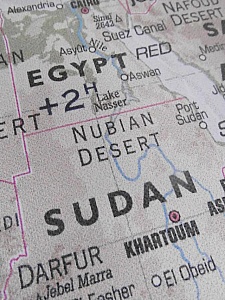
Egypt and Sudan Map
Close up of Egypt and Sudan map with names of cities and states
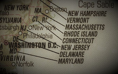
Old Map of the east coast of the USA
Old Map of major cities on the east coast of the USA
Map Background Shows Geography Of Globe And Countries
Map Background Showing Geography Of Globe And Countries
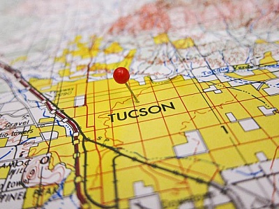
Tucson Map
a red pin on a map over tucson
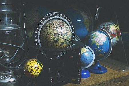
Assorted Globes Displayed on a Shelf
A variety of different types of globes are neatly arranged on a shelf, showcasing a range of geographical representations and designs. Each globe offers a unique perspective on the world.
Close-up of a vintage world map focused on Asia
Detailed image focusing on the Asian continent on an antique-styled world map
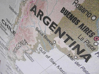
Map of Argentina
Close up of Argentina map with names of cities and states
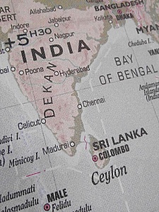
India Map
India Map
Map Background Means Geography Of World And Planet
Map Background Meaning Geography Of World And Planet
Close-up of hands holding a folded map for directions
A detailed close-up shot depicting a pair of hands holding a folded map, examining it for directions, emphasizing travel, exploration, and adventure.
The Rink At Rockefeller Center
Ice skating at Rockefeller Center in New York City
Find even more royalty free stock photos from the world's best photographers
View
of
3
Try your search on Shutterstock:


.jpg)

.jpg)


.jpg)