Log in
Email
Password
Register
Menu
Explore
Newest photos
Popular photos
Contribute
Submission guidelines
Photographer signup
Photographer login
About
About Freerange
Image license
API
Contact us
Support
Contact support
FAQ
Login
Login
Register
Search all
Photos
Illustrations
Match All
Match Photo ID
Newest
Popular
Select Category
AI Generated
CC0 Images
Editorial and News
Animals & Insects
Architecture
Architectural Details
Arts & Music
Backgrounds & Textures
Cities and Modern Life
Business & Office
Flowers and Plants
France
Food & Drink
Holidays & Occasions
Health and Fitness
Landmarks
Interiors
Illustrations
Industry & Agriculture
Landscapes & Nature
Letters and Numbers
Objects
Other
Military
People
Signs & Symbols
Sky and Clouds
Space
Sports & Recreation
Technology
Wallpapers
Free Stock Images
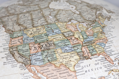
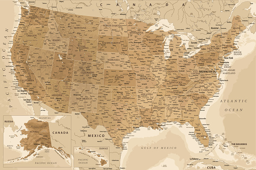
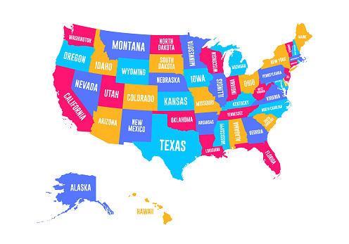
Map of the United States on a Table
A detailed map of the United States is spread out on a wooden table. The map shows all 50 states with their boundaries clearly defined.
Download options:
testing
Share
Full size image
3500 x 2333 - 1.09mb
Medium - Social media size
970 x 646 - 0.12mb
Small - Blog size
640 x 426 - 0.06mb
Send to PIXLR to edit
Image will load in PIXLR
Login to Download
Login to Download
Need to Register?
Photographer:
Unsplash
30277 images
Categories:
CC0 Images
Keywords:
(click to search)
map
United States
table
wooden
states
boundaries
detailed
geography
America
USA
educational
learning
topography
land
regions
divisions
territories
interstate
cities
towns
capitals
geographic
cartography
display
study
informative
information
visual aid
educational tool
geography lesson
learning tool
American map
educational resource
tabletop
flat
spread out
nationwide
educational material
Show all keywords
Sponsored images from iStock
View footage results
Click to save 15% sitewide with code
FREERANGE15
View More
Comments:
View all 0 comments
Try your search on iStock:


Comments:
View all 0 comments