Log in
Email
Password
Register
Menu
Explore
Newest photos
Popular photos
Contribute
Submission guidelines
Photographer signup
Photographer login
About
About Freerange
Image license
API
Contact us
Support
Contact support
FAQ
Login
Login
Register
Search all
Photos
Illustrations
Match All
Match Photo ID
Newest
Popular
Select Category
AI Generated
CC0 Images
Editorial and News
Animals & Insects
Architecture
Architectural Details
Arts & Music
Backgrounds & Textures
Cities and Modern Life
Business & Office
Flowers and Plants
France
Food & Drink
Holidays & Occasions
Health and Fitness
Landmarks
Interiors
Illustrations
Industry & Agriculture
Landscapes & Nature
Letters and Numbers
Objects
Other
Military
People
Signs & Symbols
Sky and Clouds
Space
Sports & Recreation
Technology
Wallpapers
Free Stock Images
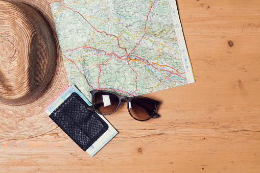
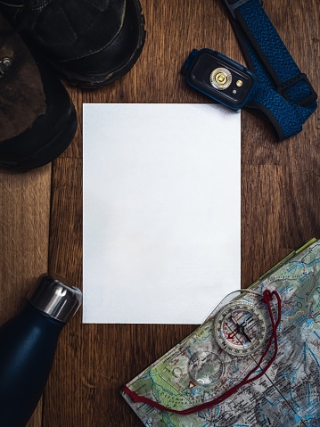
Close Up of a Map on a Table
A close-up view of a detailed map spread out on a wooden table, showing various geographic locations and markings. The map is neatly folded and partially open, with a few areas highlighted with colored markers.
Download options:
testing
Share
Full size image
3500 x 2333 - 0.74mb
Medium - Social media size
970 x 646 - 0.09mb
Small - Blog size
640 x 426 - 0.04mb
Send to PIXLR to edit
Image will load in PIXLR
Login to Download
Login to Download
Need to Register?
Photographer:
Unsplash
30277 images
Categories:
CC0 Images
Keywords:
(click to search)
map
close up
table
detailed
geographic
locations
markings
wooden
unfolded
folded
highlighted
colored
markers
cartography
navigation
spatial
exploration
destination
travel
planning
geography
paper
cartographer
study
research
continent
country
region
city
town
street
direction
scale
legend
compass
coordinates
grid
topography
data
information
Show all keywords
Sponsored images from iStock
View footage results
Click to save 15% sitewide with code
FREERANGE15
View More
Comments:
View all 0 comments
Try your search on iStock:


Comments:
View all 0 comments